
Map of the Christmas Markets in Frankfurt
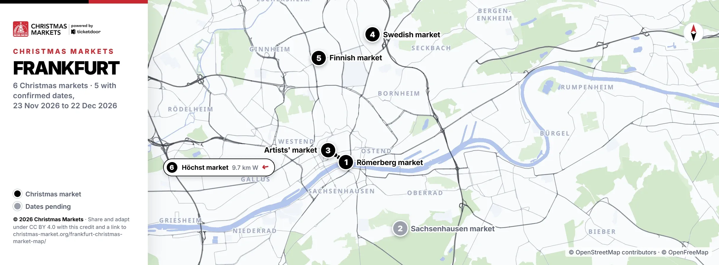
What the numbers on the Frankfurt Christmas Market map mean
The map of the Frankfurt Christmas Markets numbers 6 markets: pins 1 and 3 in the old town, 4 and 5 to the north, 2 south of the Main and 6 out west in Höchst. The overview of Christmas Markets in Frankfurt lists what each one sells.
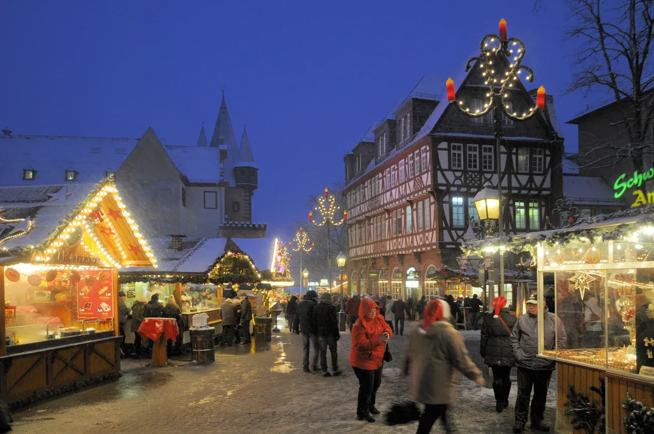
1. Frankfurt Christmas Market
Pin 1 stands on Römerberg, by the Römer and the Christmas tree, and every distance on the map is measured from it. From there the market spreads north to Paulsplatz, Hauptwache, Friedrich-Stoltze-Platz and the Roßmarkt, and south to the riverside Mainkai by the Eiserner Steg footbridge. Pin 3 is 0.1 km away.
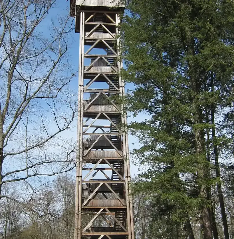
2. Sachsenhausen Christmas Market
Pin 2, drawn in grey, marks the woods by the Goethe Tower at the edge of the city forest in Sachsenhausen, on the southern side of the river Main. In a straight line it lies 3.2 km south-east of Römerberg, with dates for 2026 still to come.
Photo: the Goethe Tower in 2023 by Stefan Oemisch (CC BY-SA 4.0)

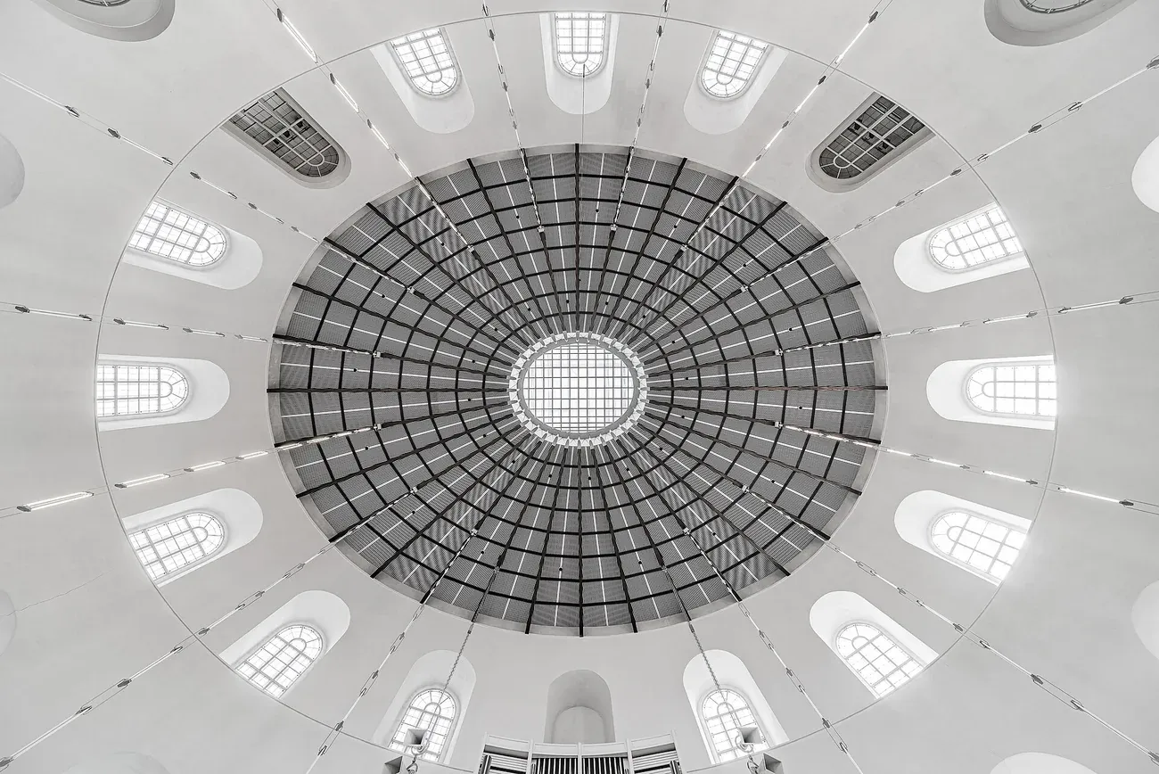
3. Frankfurt Artists' Christmas Market
Pin 3 marks St Paul's Church on Paulsplatz, 0.1 km north-west of Römerberg in the old town. This indoor art market, run by BBK Frankfurt, uses the church and the halls of the Römer next door, so its two buildings sit among the squares of pin 1.
Photo: the dome of St Paul's Church in 2022 by T meltzer (CC BY-SA 4.0)

4. Swedish Christmas Market
Pin 4 is the Swedish Church at An der Wolfsweide 54 in Preungesheim, 4.3 km north of Römerberg as the crow flies. The Swedish Church runs the market, and the Finnish market at pin 5 lies 2.0 km from it towards the south-west.
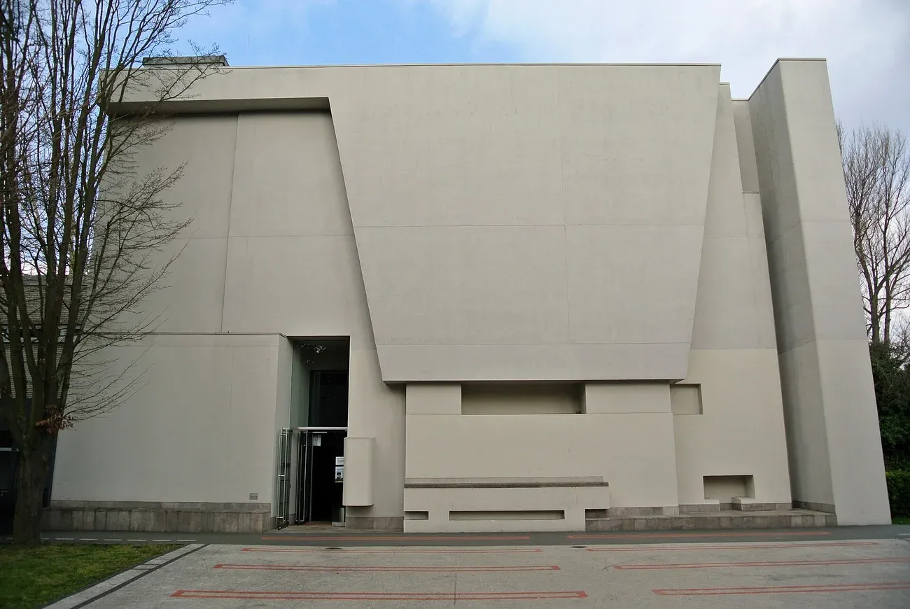
5. Finnish Christmas Market
Pin 5 sits at the Dornbusch Church, Carl-Goerdeler-Straße 1, in the Dornbusch district, 3.4 km north of Römerberg. The Finnish congregation holds its market there, and the Swedish Church at pin 4 is its neighbour on the map.
Photo: the Dornbusch Church in 2014 by Gaki64 (CC BY-SA 3.0)

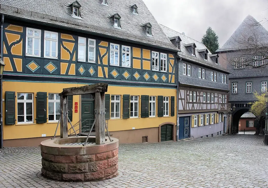
6. Höchst Christmas Market

Printable Frankfurt Christmas Market map PDF
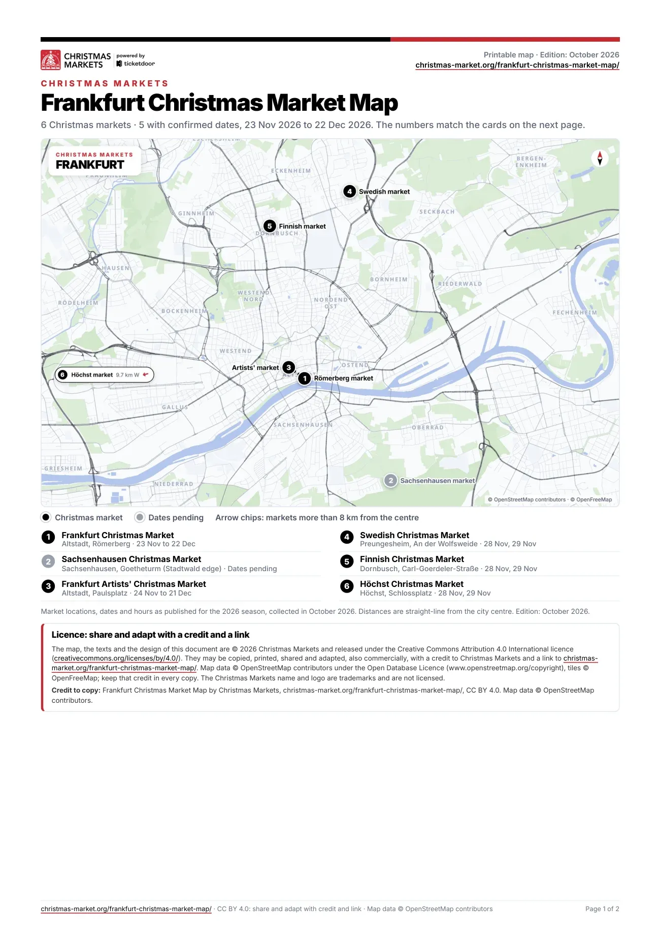
Printable Frankfurt Christmas Market map PDF
The PDF has two A4 pages. Page 1 carries the map with its 6 numbered pins and a legend giving the area of each market and its 2026 dates, or a note that they are pending. Page 2 takes the markets one by one in map order: address, 2026 dates, weekly hours and special-day hours where announced, highlights, food and drink, and type. In English, 0.9 MB. Edition: October 2026.
How to get between the Christmas Markets in Frankfurt
In the old town, pins 1 and 3 are neighbours just 0.1 km apart. The Swedish market (4) and the Finnish market (5) form a northern pair, 2.0 km from each other. The Sachsenhausen market (2) is across the river, 3.2 km south-east of Römerberg, and the Höchst market (6) is far out in the west. Distances are straight-line.
For the Frankfurt Christmas Market, U4 and U5 stop at Dom/Römer and trams 11, 12 and 14 at Römer/Paulskirche. The S-Bahn and other U-Bahn lines run to Hauptwache, 5 minutes on foot from Römerberg. The organiser's guide to the market squares and getting there lists the stops, car parks and road closures.
The event has no parking of its own; four multi-storey car parks lie close by, Dom/Römer, Hauptwache, Konstabler and Börse. Between the Alte Brücke and the Untermainbrücke, the Mainkai is closed to cars.
Licence
The map, the PDF and the texts are © 2026 Christmas Markets and can be copied, shared, printed and adapted, also commercially, under Creative Commons Attribution 4.0 International. The only condition is a credit to Christmas Markets with a link to this page. Map data © OpenStreetMap contributors (ODbL), tiles © OpenFreeMap: keep that credit too.
Plain text: Frankfurt Christmas Market Map by Christmas Markets, christmas-market.org/frankfurt-christmas-market-map/, CC BY 4.0. Map data © OpenStreetMap contributors.